Skip to content Skip to left sidebar Skip to footer

Great Torrington Town Council

Mill Street?

Mill Street is a very old street of mainly terraced houses which drops down the hill from the town to the river.  It starts from the corner of South Street and Halsdon Terrace and winds down to the site of the old ruined dairy at Taddiport.  The Methodist Chapel is at the top and the Torridge Inn is at the bottom.

The road is narrower and steeper at the top where it is one-way only from where Warren Lane joins Mill Street.  However, people have been seen driving down: during the snow in 2010; when road works closed New Street in 2011 and a complicated diversion was set up; and at other times, if the fancy takes them!

Mill Street was the escape route taken by Royalist soldiers fleeing to the west after their defeat at the Battle of Torrington in 1646.  Originally, all the houses were thatched, some of them up until the 1960s, but the only thatched buildings remaining are Rose Cottage and the Torridge Inn down at the bottom of the street.

Those houses on the south side of the street have very steep gardens plunging down to the commons by the river, while those on the other side of the street have gardens sloping up to the Mill Street common to the north.  Some of the old houses have been divided into two, while others are two houses joined into one, and gardens are often irregular in shape with complicated rights of access.  There is a ‘drangway’ between numbers 84 and 86 leading up to Mill Street common and a steep pathway down towards the river between numbers 101 and 103.

Some of the houses, mainly on the north side of the street, have a well indoors or in the garden and there used to be wooden doors in the wall under the pavement which led to water supplies of some sort.

There has been a change in usage in many of the buildings over the years.  Barns and sheds have been incorporated into houses, and shops and businesses have disappeared.  Number 130 used to be a fish and chip shop and at number 29, on the corner of Sandfords Gardens, was a shop selling groceries, bread and general supplies.  There were four other pubs besides the Torridge Inn in the 19th century: the Canal Inn at number 120 (which burnt down in 1859), the Greyhound, the Nelson and the Plymouth (behind Mill House).

The high pavement (which was known as ‘the course’) on the north side of the street had railings added some 25 years or so ago and ramps built down to the roadway.  People who lived in Mill Street as children in the 1950s remember playing out in the street (when they weren’t scrumping apples from Sandfords’ orchards nearby) but there is too much traffic and too many parked cars for that to be possible these days.

Many of the houses in Mill Street have interesting histories.  The present owners of number 129 have traced documentation dating back to 1640.  Over the centuries their house has been occupied by people involved in a variety of trades – woollen draper, cordwainer, ropemaker, tallow chandler, weaver, fuller, dyer and carpenter – which were carried on in outhouses behind the house.

The solid stone house, number 127, is still known as ‘the police house’ although it wasn’t built for that purpose.  It was used as a police house by Devon County Council between 1919 and 1961 when it was sold back into private ownership.

The row of connected houses, numbers 61-67 on the south side of the street, were known as ‘Hoopers Cottages’.  At one time they all caught fire when burning on the commons (‘swayling’) got out of control and the thatched roofs went up in flames.  The houses were left derelict for some time until they were restored in the late 1930s.

Number 49 used to be a religious meeting house, possibly for Quakers or Non-Conformists; the early Methodists had a ‘preaching-room’ in a cottage in Mill Street.  Although this isn’t apparent from the front, and the inside of the house has been altered considerably, the back of the house has a roof and upper window shaped in a pointed arch which gives a clue to its former usage.

Number 39, a tall house with a room in the roof, is believed to have been built onto two small cottages which now form the rear part of the house.  This property is thought to have belonged to the head gardener at Caynton House, just up the road, as it has a wide hallway supposed to have been to accommodate his wheelbarrow.  Coincidentally, the present owner is a gardener and plant expert.

Mill House, number 19, is a substantial stone-fronted property with outbuildings in the rear courtyard.  In 1842 there were two cottages on this site with the Plymouth Inn behind them.  In 1901 the house was lived in by Thomas Andrews, a local photographer whose postcards are collected to this day.

Number 1 Mill Street was built in 1808.  In the 1840s it was known as ‘The Retreat’ and then in 1903 as ‘Revette’.  After 1904, over the next 50 years or so, the house was owned by several descendants of Thomas Fowler (the inventor after whom the IT centre at Castle Hill was named) who all shared his name.

On the other side of the street is the Old Coach House, a tall, three storey building.  It was converted in the 1930s out of the stables and coach house belonging to Penhallam next door.

Probably the finest house in Mill Street is Caynton House, a Grade II listed property built in 1725 set back off the road and looking over the Torridge valley.  It is thought there was once a pottery on this site as sherds and the remains of a kiln were found when the three houses in Caynton Court were built in the grounds.  The Yonge family, who came from Caynton in Shropshire, hence the name of the house, lived there for many years.


How long has the building in South Street that looks like a church been a Members’ Social Club?

Torridge Vale Social Club celebrated its 60th anniversary on 13th June 2009.  An open day was held from noon until late.  Over 200 former dairy workers came along to look at a display of old photographs and to reminisce over a pint (not milk!) with former colleagues.  Evening entertainment was provided by the band ‘Morpheous’.

In around 1865 the Bible-Christian Methodists erected a chapel on a site purchased from the Torrington Town Trustees in South Street, on which formerly stood an inn called The Boot.  A building was later added at the rear for a Sunday School, which had a library of some 200 books, and a residence for the pastor.  This chapel was opened for public worship in October 1866.  In 1927 the Bible-Christians united with the United Methodist New Connection which, in turn, united with the Wesleyan Methodists in 1932.  Public worship was discontinued here and the chapel building was sold to the Torridge Vale Dairies Company for use as a packing station and store.  It is believed the building was used during the Second World War to pack parachutes.  

In 1949 the building became the Unigate and Torridge Vale Social Club.  After the dairy closed, in 1993 the members purchased the Social Club building from the Company and continued to run it as a members’ club.

The building originally had a snooker room but no bar or function room.  Jim Thacker, who worked at the dairy from 1957 until its closure, is still on the committee.  He says, ‘In the 1960s a licence was difficult to get – we had to go to court a few times.’  Eventually, the club got its licence and a bar and skittle alley were put into the building.  In the early 1970s a lounge bar was built and, as with the skittle alley, the work was done mainly by volunteers.

When the dairy closed, Jim Thacker, together with other local men, Graham Martin, Chris Stacey and Roy Lee, bought the club for members.  People who were not former dairy employees were invited to join the club.  The function room provides a good venue for celebrations.  Jim Thacker says, ‘It is a vital part of the town and we are very proud of what we have done to turn it into a thriving club that serves the community.’  Profits made go back into the club and decisions are made democratically.

The present chairman, Roger Payne, was approached in late 2013 by the Torrington Police Amateur Boxing Club who were looking for a permanent place to have their gym.  After discussions with the committee, the boxers were offered an unused storeroom at the front of the building.  They themselves converted it into a fantastic gym, complete with practice ring and exercise machines, for use by junior to senior boxers.  This is a credit to Torridge Vale Social Club.

Torridge Vale Social Club has approx. 900/1000 members at the moment.  In 2019 the club will have existed for 70 years, but no plans have yet been made to celebrate this.


Who were the Rolles?

The Rolle family were Lords of the Manor for some 350 years.  They lived at Stevenstone in the adjoining parish of St Giles-in-the-Wood.  George Rolle (c1485-1552), who acquired the manor of Torrington from the Fortescue family in Henry VIII’s time, was the founder of the dynasty which came to an end with the death of Mark Rolle in 1907.

Amongst George Rolle’s descendants were Dennys Rolle (1614-1638), known for his intellect and amiability, who made many benefactions to the people of Torrington during his short life, including the foundation of the Blue Coat School.

Sir John Rolle (1626-1706) was knighted by Charles II in 1660.  He had remained loyal to the King during the Civil War, helped Charles II financially when he was in exile, and actively supported the Restoration.

Another Dennys Rolle (1720-1797) was Mayor of Torrington for two terms and Recorder from 1781-97.  He was also MP for Barnstaple from 1761-74.  He was a colourful character who had many interests and adventures including a failed attempt to set up a colony in Florida.  He was very interested in natural history and liked working on the land himself.  He provided schools and garden allotments for the poor.  He died under a tree in June 1797 while walking between his estates of Stevenstone and Hudscott (near Chittlehampton).  He was the first to propose building a canal at Torrington in 1793.

John Lord Rolle (1750-1842) was elected MP for Devonshire in 1780 and retained the seat in the general elections of 1784 and 1790.  He was a supporter of Pitt and a staunch Conservative.  In June 1796 he was raised to the Peerage, receiving the title of ‘Baron Rolle of Stevenstone’.  He was Colonel of the South Devon Militia and Royal North Devon Yeomanry, a county magistrate, a good landlord, liberal benefactor and supporter of the church.  He commissioned plans for the canal his father had proposed and paid for it to be built.  It was completed in 1827.  He died at Bicton, another family estate, in April 1842.

Although he was married twice, John Lord Rolle had no children and his Torrington estates were left to his nephew, the Hon. Mark George Kerr Trefusis (1835-1907), son of Lord Clinton, on the condition that he changed his name to Rolle, which he did by Royal Licence in 1852.  Mark Rolle sold the canal land for the building of a railway in 1871.  He donated land for the cottage hospital, paid for the pannier market to be roofed and for a drinking fountain to be erected in the square in 1870.  In 1868 he started the building of an extravagant new manor house at Stevenstone but in less than 100 years it lay in ruins.

Mark was the last of the Rolle dynasty.  He died leaving no male heir and his estates then passed to his nephew, Charles Trefusis, the 21st Baron Clinton.


How far do the Commons extend and for how long have they existed?

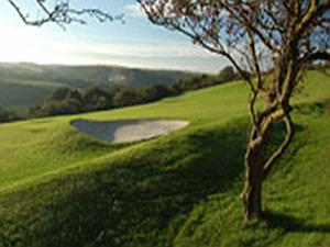
Torrington is surrounded on three sides by 365 acres (146 hectares) of common land.  The area is freely accessible to all and visitors can walk the 20 miles of footpaths which include the golf course, ancient wood and flower meadows, steep bracken and gorse covered slopes, and sheltered river valleys.

In about 1194, during the reign of Richard I, ‘a large waste called the common’ was given to the people of Torrington by the lord of the manor, William FitzRobert.  In 1889 the rights of this land were transferred, by an act of parliament, to an elected Committee of Conservators which now administers the commons.  The earliest management was mainly concerned with control over the grazing and quarrying but since 1981 grazing has stopped and various management techniques have taken its place to prevent the area reverting back to scrub and woodland.

One of the first bills to be issued in 1889 prohibited the burning of furze or gorse on the commons, known as ‘swayling’, but this activity continued judging by the number of fines listed in the Conservators’ minutes for this misdemeanour.  Swayling was part of the year’s cycle for grazing land.  Women would go out and collect ‘fuzz-stubs’ for faggots and kindling and then the land would be burnt.  The alternative was clearing by hand.  Before the Second World War one official swayling went disastrously wrong.  The wind changed and four thatched cottages in Mill Street backing on to the commons were completely gutted.

There were far fewer trees on the commons in the 19th and early 20th centuries because of animal grazing.  There were donkeys and goats, and sheep were run on the commons until 1981.  Dr O’Flaherty’s goat ran loose near seats on Castle Hill and the boys of the town enjoyed baiting the billy goat.  There was a duck pond on Mill Street common and geese and hens were everywhere.  There used to be hunting around Furzebeam and meets at the Old Bowling Green in the 1960s as well as informal shooting and rabbiting.

Various sports have taken place on the Old Bowling Green in the past – football, hockey, shinty, golf, bowls, and the Coronation Sports of 1902 – and the area is now the setting for the Cavaliers’ bonfires which take place every five years or so.

Past generations have happy memories of playing on the commons with their friends, making dens in the bracken and under shrubs, playing football, hide-and-seek and ‘tin can’ (throwing a ball at each others’ legs). They would swim in the river and go fishing, catching eels and having mud ball fights, or ride down ‘Sliding Rock’ on Castle Hill on tin trays.  

There is a wide variety of flora and fauna to be seen on the commons and lists of these, together with suggested walks, can be found in pamphlets available at Torrington Information Centre.

What is the Tarka Trail and where is it?

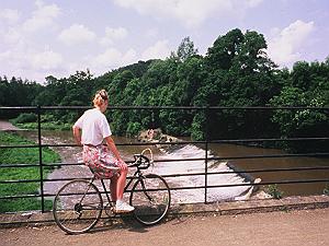
The Tarka Trail is a recreational route opened in May 1992 which describes a figure of eight, centred on Barnstaple, through the beautiful countryside of North Devon.  It extends for 180 miles (290 km) and different parts of the trail can be covered by rail (the Barnstaple to Eggesford section of the Tarka Line), on foot or by bicycle.

The part of the Tarka Trail that is nearest to Torrington follows the route of the old railway line which opened in 1872 but fell to Beeching’s axe in 1965, although freight continued to be transported until 1982.  About a mile out of town on the A386 towards Bideford is the old Torrington railway station which, since 1984, has been a pub, restaurant and café called the Puffing Billy.  Nearby is Torrington Cycle Hire and families can often be seen cycling along the trail at weekends and holidays.  A group of railway enthusiasts are hoping to return a railway to Torrington.

Going in a southerly direction, you can walk or cycle via Watergate Bridge, East Yarde and Petrockstowe to Meeth Halt (11.4 miles/18.3 km).  In the other, northerly, direction the trail crosses over the River Torridge several times as it winds through the meadows and woods.  It passes the village of Weare Giffard on the far side of the river, goes through an echoing tunnel and then crosses the river via an iron bridge and continues alongside the Torridge estuary to Bideford.  (Torrington to Bideford is 5.3 miles/8.5 km).        

Beyond Bideford is Instow, which overlooks the Taw and Torridge estuary, and Fremington, once an important port, and then the trail goes alongside the River Taw – at a distance – to Barnstaple.  The cycle track crosses the river and, on the other side, leads on to Braunton which marks the end of the stretch where it is possible to cycle.  Beyond Braunton to Croyde, Woolacombe, Ilfracombe, Combe Martin, Lynton and Lynmouth the trail is for walking only and is partly along the South West Coast Path.  You can then follow an inland route back to Barnstaple.

From Torrington, in the southerly direction, it is possible to cycle as far as Meeth but, before Meeth, the trail continues, for walkers only, to Dolton, Iddesleigh, Hatherleigh, Jacobstowe to Okehampton and on to Belstone, Sticklepath and South Tawton on Dartmoor and then, via North Tawton and Bondleigh, to Eggesford where you can catch the train back to Barnstaple.

The Tarka Project was set up in 1989 with the aim of protecting and preserving the environment which led to the creation of the Tarka Trail.  Its name was inspired by Henry Williamson’s classic novel, ‘Tarka the Otter’ (1927) and takes the traveller through the contrasting landscapes of ‘Tarka Country’ described in the book: peaceful countryside, wooded river valleys, rugged moorland and dramatic coast.  Tarka was born and died near Torrington so, in one sense, this is the beginning and end of the trail.

When was the Torrington Canal in operation and where was it?

The Torrington Canal, also known as the Rolle Canal, was in use between 1827 and 1871 when it was replaced by the railway which was built over sections of the same route.  It was seven miles long from Sea Lock, a tidal lock on a bend of the Torridge in the small parish of Landcross, to Torrington.

John Lord Rolle, lord of the manor, set about having a canal built in 1823 so that heavy goods such as lime, coal, clay, sand and timber could be brought inland from the port of Bideford.  Civil engineer, James Green, designed a canal similar to the one at Bude that he had recently constructed using inclined planes instead of locks and along which square tub boats would be hauled by horses.

From Sea Lock the canal ran in pretty much a straight line to Annery Kilns, across the river from Weare Giffard, where there were three large lime kilns and a shipyard nearby where the tub boats for the canal were most likely built.  

From Annery Kilns the canal curved in a gentle arc to a wide basin at the foot of the inclined plane at Ridd where the boats were hauled up singly some 40ft by means of a continuous chain worked by a massive wooden wheel.  Once they reached the upper basin, the boats continued along the canal which ran along the western bank of the Torridge on a ledge cut into the steep hillside above the river and then turned sharp left over an aqueduct which is now the entrance drive to Beam House.

The next section of the canal curved around the steep slope of Furzebeam Hill high above the River Torridge and then crossed open fields to Staple Vale at the foot of Torrington commons, under the road leading to Rothern Bridge and alongside the river to the bottom of Mill Street by the bridge at Taddiport.  The canal basin here was the main centre for the canal and its various enterprises.

It was originally intended that the canal should only extend as far as Taddiport but lobbying from farmers further inland persuaded Lord Rolle to extend the canal under Castle Hill alongside the Torridge to the New Town Mills (now Orford Mill holiday apartments) at Woodland Ford.  The New Town Mills had their own wharf on a large canal basin which also served as a mill pond for the water-powered corn mill and saw mill.  Beyond the mill basin the leat was extended and widened to take the canal a further 200 yards to the site of five new lime kilns completed in July 1827 at Rowe’s Moor, the largest group of kilns in North Devon.

Eventually, the canal extended beyond Rosemoor through Darkham Wood to the weir on the Torridge rebuilt in 1837 to ensure a reliable flow of water in the canal at all seasons.  A stone quay was constructed at the end of the canal next to the weir which was known as Healand Docks.

At first the canal was profitable but it became ever more expensive to maintain and closed in 1871 when the new lord of the manor, the Hon. Mark Rolle, supported the building of a railway which would link Torrington to larger towns.  The Bideford to Torrington railway line was opened on 18th July 1872.

Mayfair in the 1920s & 30s

Two women who were children in the 1920s and 30s told me what Torrington May Fair meant to them.  They still remember how excited they were.  At a time before there was television and a wide variety of activities and entertainments, May Fair was a great event in their lives.  

They loved taking part in the floral dance and organised their groups of four soon after Christmas.  The dancers would start out from the pannier market led by four local butchers in their best butchers’ apparel and their wives who wore elaborate dresses and hats.  Everyone bought a balloon and the boys would prick them all before you started!  In those days the dancers went up South Street, along Halsdon Road, down New Street and back along Potacre Street and Cornmarket Street to the square, followed by the May Queen and her attendants in a horse and cart driven by Tommy Hearn and decorated with gorse.  The floral dance took place twice, morning and afternoon.  They remember the children from Sydney House taking part in the afternoon, all wearing sun bonnets.  They were frail children and exhausted by the time they had finished.  They also remember a group of foreign visitors taking part in the dancing one year, wearing their own national costume.  They had a wonderful time but did their own version of the dances.  Eventually, Miss Mortlock, who was headmistress of the Board School, went over to them and said, ‘Do you mind?’ as they were completely dominating the whole event!  

They remembered the excitement of the fair:

‘We were thrilled by all the rides, the colourful lights and the music.  The fair was owned by Granny Lock and all the local lasses were smitten by her handsome, swarthy sons.  “Go ‘ome and leave my boys alone!” Granny Lock used to shout, while her sons just looked amused.’

By 1939 the programme had expanded considerably.  After the floral and maypole dancing and the crowning of the May Queen in the morning, an open-air boxing tournament was staged at the Vicarage Field in the afternoon.  In the evening, the final for the Torridge Association Football Cup between Ilfracombe and Holsworthy was held.  A Royal Naval band was in attendance throughout the day.  On Saturday there was a cross-country race over Castle Hill and a river boat race from Town Mills to Taddiport.  In the evening, a carnival brought the celebrations to an end and the funfair continued into the night.

The Bishop of Exeter attended the 1939 May Fair and contrasted the festivities in Torrington that day with what was happening in other countries in the build up to the Second World War.  He said no doubt the times were serious, but to be serious did not necessarily mean to be solemn, and people would probably go back to the serious business of life all the better for having forgotten, for a day at least, what was going on elsewhere.

Is the town called Torrington or Great Torrington

Officially called Great Torrington, to distinguish it from nearby Little Torrington and Black Torrington, the town is more generally known simply as Torrington.  This can sometimes lead to confusion when searching for the town in a list – whether to look under G or T!

Before the middle of the 8th century, there were probably three farms or estates on the bank of the ‘Toric’ (the Old English name for the River Torridge meaning ‘violent, rough stream’) which each had the name Toricton or, later, Toritun.  After the Norman Conquest this name varied between Toriton, Torinton and Torintone.  To avoid confusion, the three places were later distinguished by the prefixes ‘Chepyng’ (Market) or ‘Magna’ (Great) for the town and ‘Little’ and ‘Black’ for the villages.

Little Torrington lies about a mile and a half away from the town over the hill to the south, out of sight except for the top of the church tower.  Black Torrington is some 9 miles away, as the crow flies, higher up the River Torridge and it has been suggested that the village derives its special title from the black colour of the water or perhaps from the dense woods which surrounded it in ancient times.


The History of the Torrington Cavaliers

The Cavaliers are a band of men who do a lot of voluntary work in the community, organise fund-raising events, drink copious amounts of beer and have fun!  Their name derives from the period of the Civil War when Torrington was a Royalist, or Cavalier, town.  They are best known for the

structures they build on the commons every few years – buildings, ships, trains – which are set alight along with a fantastic firework display.  Thousands of people come from far and wide to see these enormous bonfires and huge sums of money are raised for charity.

The Cavaliers were founded in 1970.  Plymouth City Council was preparing to celebrate the 350th anniversary of the sailing of the Mayflower to America and many Devon towns were invited to join the celebrations.  Torrington sent two floats constructed by a group of local men – Carnival Queen and attendants and also a historical tableau involving the parish church, and the men dressed in hired costumes as Cavaliers and Roundheads.

That event was the beginning of the Cavaliers and was marked, as all subsequent events have been, by imagination, hard work, a swashbuckling spirit and enthusiastic drinking.  Some of their earlier antics and near accidents would horrify present-day Health and Safety Officers!  These have included sword fights, flying machines, a human cannon ball, a water carnival on the River Torridge, a wrestling night at the Plough and a snail eating contest!

The Cavaliers support a lot of local events and do a great deal of unsung work in the town.  They hang the bunting and erect the staging for May Fair each year.  They organise a bonfire and firework display at the rugby club for Guy Fawkes night.  They build Santa’s Grotto under the Town Hall at Christmas and hand out hundreds of bags of sweets to local children.  They get a lorry into the square for concerts on New Year’s Eve and organise the march through the town to commemorate the Battle of Torrington each February.

Cavalier bonfires over the years have included:

1973 Battleship Bismarck.

1974 Viking Ship with sails made by girls at Sudbury’s glove factory.

1975 American Fort Dearborn.

1976 World’s Tallest Guy, over 100ft when on the bonfire.

1990 Houses of Parliament.  Descendants of the Gunpowder Plotters – Fawkes, Catesby and co. –  came down to Torrington to join in the event.

1991 Great Train Robbery.

1996 Torrington Church as part of 350th anniversary commemorations of the Battle of Torrington when the church was partially blown up.

2000 Great Fire of London (Pudding Lane).

2005 Nelson’s Victory, a truly superb half-scale model of the ship.

2010 Medieval Castle symbolising the one which once stood on Castle Hill.

2015 Trumpton, the village featured in the children’s TV programme, popular in the 1960s.

Their next bonfire, in August 2020, will be a model of the Mayflower on the 400th anniversary of its sailing to America.

How old is Great Torrington?

The first mention of Torrington is found in the Domesday Book but evidence has been discovered of settlement in the locality long before that date.  Flint tools from the Neolithic age have been excavated at Weare Giffard and Bronze Age artefacts and human remains have been found in ancient burial mounds (tumuli) near Torrington.  Stones of the Saxon period were found on the site of the old castle when the foundations of the new bowling club pavilion were being prepared in 1987.

William the Conqueror reached Devon early in 1068 and occupied the whole county within a year.  He distributed the large estates forfeited by existing landowners among his Norman followers, reserving some for his own use.  Odo was the Domesday holder of Great Torrington and may be regarded as the first baron of Torrington.  His descendants and heirs took the surname ‘De Toriton’.

The 12th and 13th centuries were the great age of colonisation which took the form of the spread of settlement and the cultivation of the countryside.  The other aspect of the colonisation movement was the creation of ‘boroughs’ by lords of rural manors.  All of them had a weekly market, many of them an annual fair.  Torrington became a borough in the 12th century and by the 13th century was known as ‘Chepyng (market) Toriton’.

Torrington was in and out of the hands of a succession of barons who were related to, or in favour with, the current king and then fell out of favour.  When Richard III was killed at Bosworth in 1485, Henry VII took possession of the baronies of Barnstaple and Torrington but two years later handed them over to his mother, Lady Margaret, Countess of Richmond and Derby.  Her grandson, Henry VIII, inherited much of her property including Torrington but in about 1525 he granted it, with other North Devon properties, to his illegitimate son, Henry Fitz Roy, Duke of Richmond and Somerset.  Fitz Roy died suddenly in 1536 and Henry VIII then granted Torrington to his childhood friend, William Fitz William.  

In about 1554 the manor of Torrington was bestowed by Queen Mary on James Basset, a member of her Privy Council.  He was a son of Sir John Basset of Umberleigh and his wife, Honora, was daughter of Thomas Grenville of Bideford.  It may have been through James Basset’s influence that a charter of incorporation was conferred on Torrington in 1554.  James Basset’s son, Philip, sold the manor of Torrington to Sir John Fortescue (c1531-1607) who left it to his younger son, William, from whom it was purchased by the Rolle family.

George Rolle (c1485-1552), who had acquired the property of Stevenstone in the adjoining parish of St Giles-in-the-Wood during Henry VIII’s time, was the founder of the Rolle dynasty which lasted for more than 350 years until the death of Mark Rolle in 1907.